StratoBayes uses Bayesian AI to automate subsurface correlation, quantify geological uncertainty and help geoscientists make faster, more defensible decisions across energy, carbon storage, mining and infrastructure.
Durham University spin-outPeer-reviewed methodUK patent granted
Subsurface interpretation today is manual, slow, subjective and hard to defend. One in five wells misses its target, and a mis-placed well incurs costs in the millions of pounds. StratoBayes produces ranked interpretations with quantified uncertainty, helping geologists and exploration teams reach better decisions in hours instead of weeks.
Manual correlation of multi-well datasets can take weeks. StratoBayes delivers ranked correlations in hours, so geologists spend their time on interpretation rather than alignment.
Every result carries quantified probabilities and alternative scenarios, so you know how much weight each correlated horizon can bear.
Output is reproducible and auditable, built for regulatory evidence and investment cases and grounded in peer-reviewed mathematics instead of black-box predictions.
StratoBayes evaluates your data against a peer-reviewed statistical model, weighs competing correlation hypotheses and states how confident it is in each one.
Import depth-referenced records from two or more boreholes, wells or outcrop sections, such as well logs, geochemistry and lithology.
The Bayesian engine evaluates thousands of candidate alignments, allowing sedimentation rates to vary between sites and updating its probabilities as the evidence adds up.
You receive the most probable correlations, ranked, with uncertainty estimates for every matched horizon, ready to inspect, adjust and export.
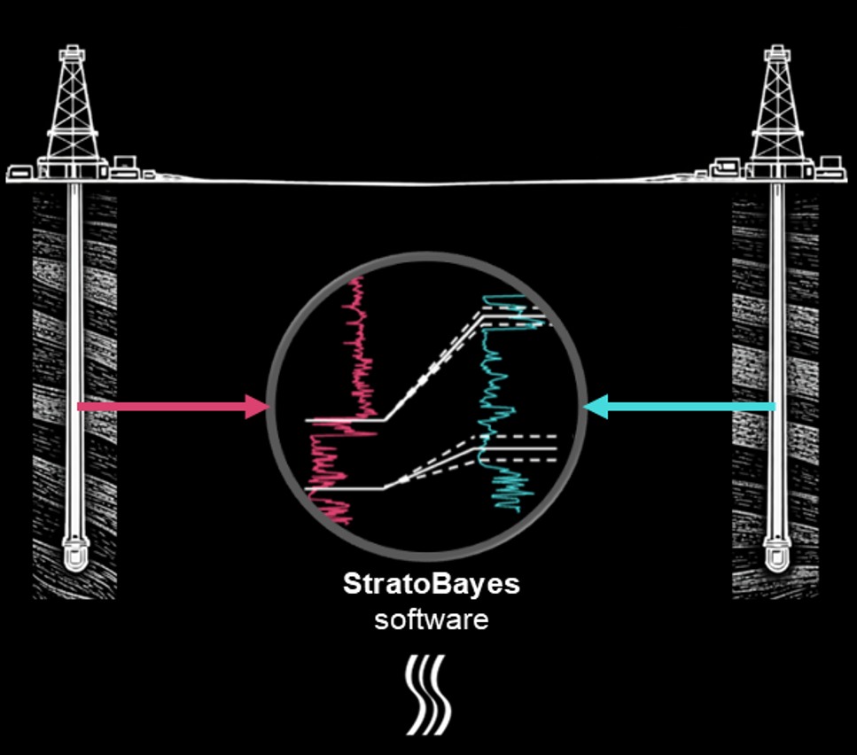
Wells in, matched horizons out, uncertainty quantified at every step.
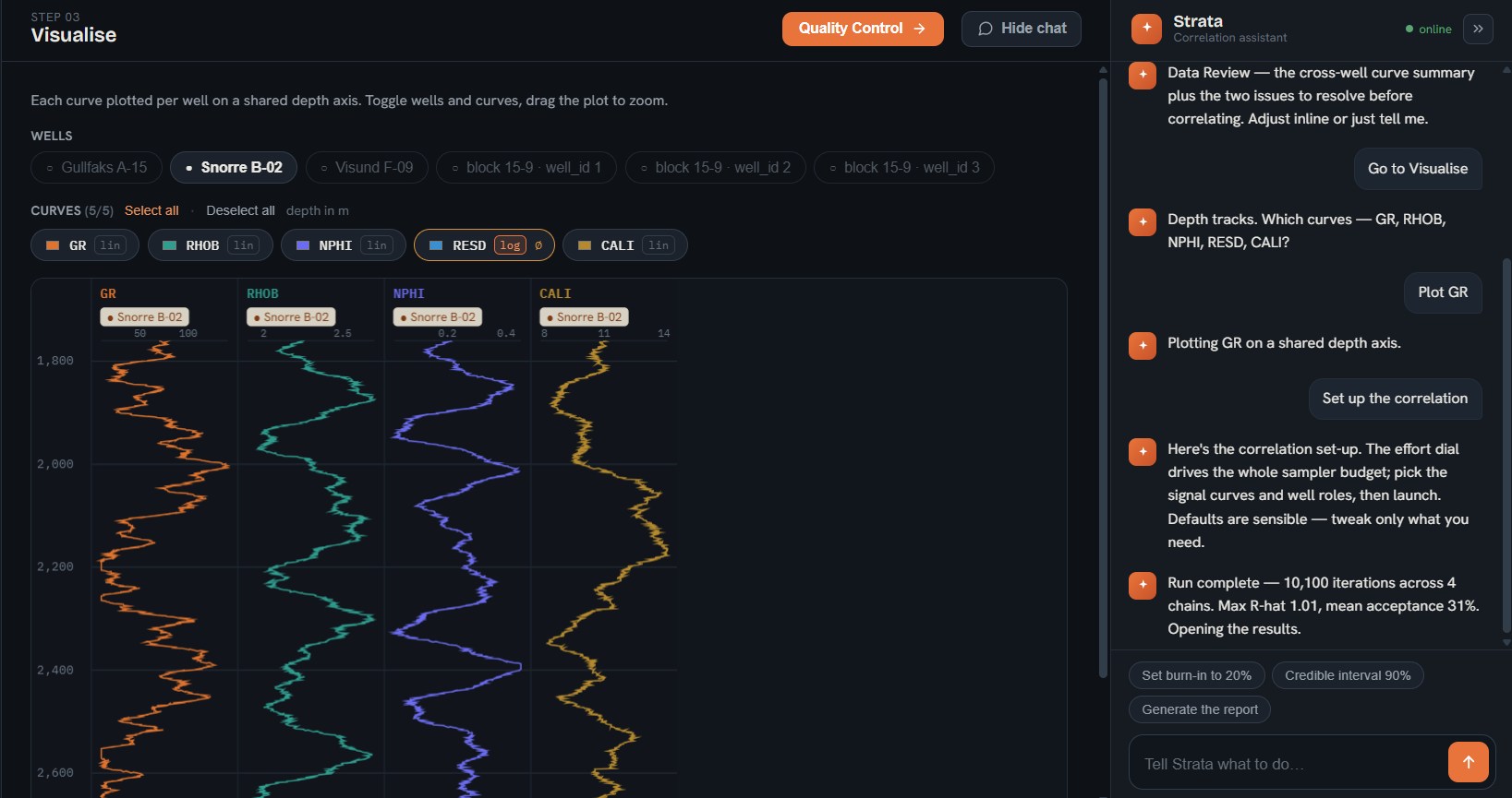
Set up the run yourself, or tell Strata, the built-in correlation assistant, what you want.
A live model run, recorded in the app.
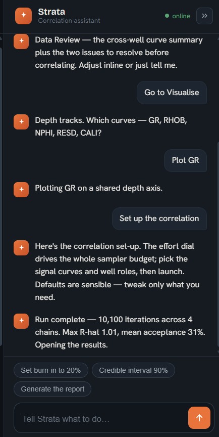
The Strata assistant sets up runs, plots curves and reports diagnostics in plain language.
Correlate storage and monitoring wells with quantified uncertainty for site characterisation and the evidence regulators expect.
Trace target horizons between wells to estimate reservoir continuity before committing to the next borehole.
Align drillhole geochemistry across a deposit to follow ore-bearing horizons and plan follow-up drilling.
Automate multi-well log correlation to keep reservoir models current through appraisal and development.
Build a probabilistic picture of the ground between site-investigation boreholes before tunnelling or foundation design.
Correlate cores and outcrop sections on to a shared timescale using the method published in Geochronology.
"This problem has existed for decades."
"It solves the critical question: what is the risk behind your interpretation? How sure are you?"
"More sophisticated than anything I've seen in this space."

Today the engine correlates boreholes with quantified uncertainty. Next, we are building a foundation model for the subsurface, with the same Bayesian engine at its core, so machines can learn the statistical structure of the ground the way weather models have learned the atmosphere.

Co-Founder & CEO
Kilian co-founded StratoBayes and leads it as CEO, running commercialisation and customer discovery. He led the StratoBayes software MVP development and validated market fit through a successful ICURe programme. That work led to the spin-out from Durham University in June 2026.
LinkedIn →
Executive Advisor & Chair
Ed is a technology non-exec, founder and investor. Former SVP of Data Strategy at Accruent, acquired by Fortive ($2bn), and CEO of Kykloud and Hicomply. As our Chair, he advises on go-to-market, fundraising and scaling.
LinkedIn →
Head of Operations & Product
Martin leads operations and product, from the roadmap through to the software engineering process. He is a palaeontologist and software developer at Durham University who has released a suite of open-source R packages for stratigraphic and phylogenetic analysis.
LinkedIn →
Head of Innovation & Modelling
Andrew brings over 35 years of quantitative modelling to algorithm design, validation and uncertainty quantification in the StratoBayes engine. He is an archaeologist at Durham University and a specialist in Bayesian methods for chronology.
LinkedIn →
Head of Stratigraphy
Matthias leads the stratigraphic side of the method and represents StratoBayes in the wider research community. He is an Assistant Professor at Trinity College Dublin specialising in stratigraphic methods and the integration of geophysical and geochemical datasets.
Trinity profile →StratoBayes Limited is the commercial venture built on research licensed from Durham University. The method is peer-reviewed, the research behind it was funded by the Leverhulme Trust, and the method is protected by a granted UK patent.
Eichenseer, K., Sinnesael, M., Smith, M.R. and Millard, A.R. (2025). StratoBayes: a Bayesian method for automated stratigraphic correlation and age modelling. Geochronology 7(4), 545-570. Read the paper
UK patent GB2643657, granted September 2026, held by Durham University and licensed to StratoBayes. International application published as WO 2025/196391 A1.
Access to the software is through the beta programme.



The UK Intellectual Property Office has granted patent GB2643657, "Method and system for correlating geological datasets", which covers the Bayesian approach at the heart of StratoBayes.
View the patent on the UK IPO registerDurham University has published the story behind StratoBayes. Research on dating the Cambrian Explosion, supported by the Leverhulme Trust and published in Geochronology in 2025, became a method for correlating subsurface data with quantified uncertainty. StratoBayes launched with £280,000 in innovation funding, commercialisation support and venture capital. Its first pilots include work with Hotspur Helium on helium exploration, and an early release is in use by more than 20 geoscientists across eight countries.
"Our goal is to provide scientists and engineers with AI that speeds up interpretation and shows how confident they can be in the result, enabling better-informed decisions in high-stakes subsurface work."Read the release on the Durham University website
StratoBayes Limited has completed its spin-out from Durham University.
Meet the teamThe Bayesian method behind StratoBayes is published in the open-access journal Geochronology. The paper sets out automated correlation and age modelling, demonstrated on Cambrian carbon-isotope records from Morocco and Siberia, and gives the first precise age estimate for the appearance of trilobites in Siberia.
Read the paperSign up to join our beta programme and you'll receive an email with installation instructions.
Thanks. Check your inbox at for your installation instructions. This can take a few minutes.
Prefer a walkthrough first? Book a demo.